Final Ground Control System
By Avionics Team | March 16, 2025
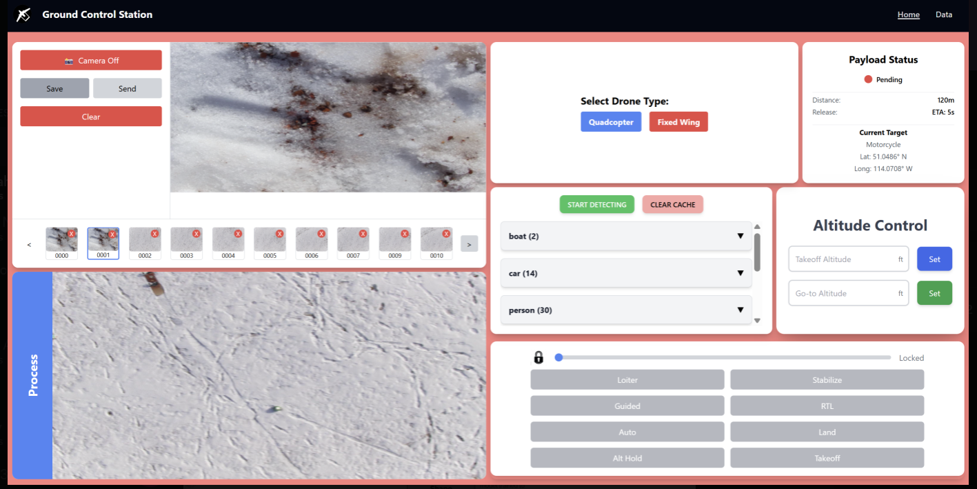
UI Screenshot of GCS
After months of development, we have finalized our Ground Control System (GCS), which integrates real-time UAV controls, image processing, and payload management into a unified interface. This system is now capable of live-streaming UAV footage, running AI-powered object detection, and dynamically updating UAV waypoints based on detected targets.
In the screenshot, we can see various functionalities of the GCS:
- Image Processing & Object Detection: The system detects and classifies objects such as boats, cars, and people using AI models, displaying detection results in real time.
- Payload Management: The payload status panel tracks target positioning and calculates release timing, ensuring accurate drops.
- Flight Mode Control: Pilots can toggle between different flight modes (Loiter, Auto, Stabilize, RTL, etc.), allowing flexibility in UAV operations. It also has a slide to lock/unlock for security purposes.
- Altitude Control: The altitude control panel lets users set precise altitude levels for different mission phases.
Target Detection and Coordinate Review
One of the most powerful features of our GCS is the ability to review all detected targets through a dedicated object viewer. For each object detected by the onboard AI model, the GCS displays a projected latitude and longitude, visible both in a live feed and through a categorized dropdown menu.
Each dropdown corresponds to an object class and lists all coordinate detections for that object. If the AI introduces a misclassification or a spatial outlier, users can manually delete individual coordinates to clean the dataset before uploading a mission.
We also introduced a color-coded map overlay to visualize spatial patterns across detections. Outliers are automatically shaded in lighter colors, making it easy for the team to quickly identify and correct bad data before executing a precision payload drop or uploading mission waypoints.
This interface allows operators to combine the power of real-time autonomy with the reliability of manual quality assurance — delivering both flexibility and confidence for competition flights.
With this final version, we have successfully bridged the gap between image processing and autonomous UAV navigation. This milestone brings us closer to deploying our UAVs in real-world search-and-rescue and reconnaissance missions.
Key Achievements:
- Integrated Flight Modes
- Integrated Image Processing
- Real-Time Coordinate Filtering and Outlier Review
- Finalized the Ground Control System
GCS Feature Gallery
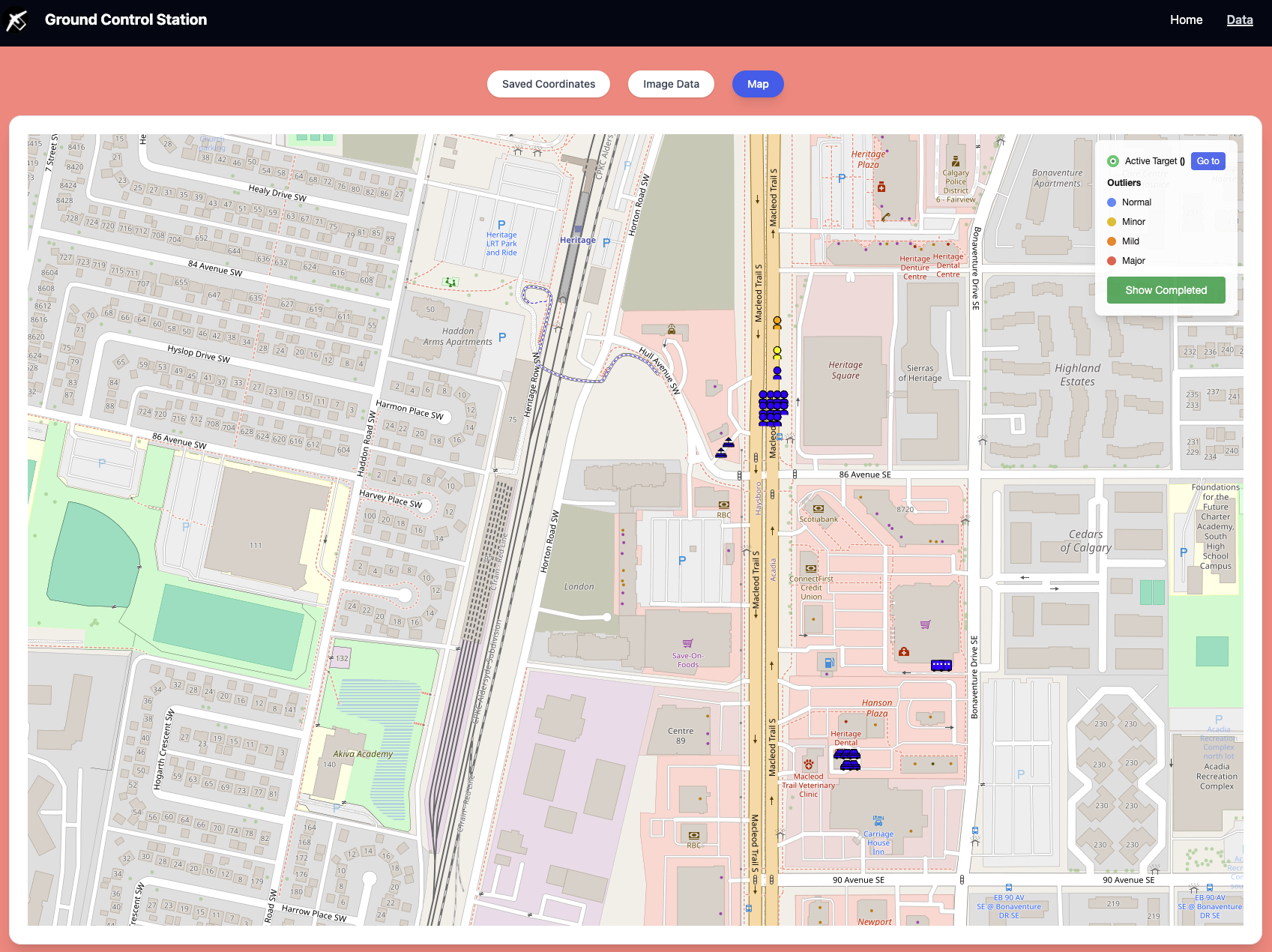
Map with color-coded detections for outlier filtering
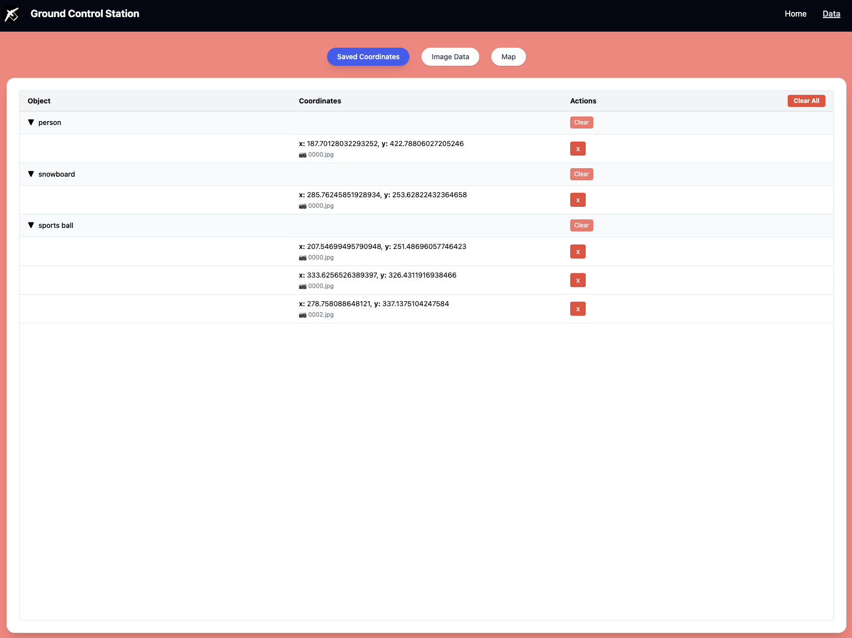
Dropdown viewer with coordinate lists for each detected object