Perfecting the Aerial Mapping with ODM
By Avionics Team | March 22, 2025
Progress Summary for our latest flight mapping data
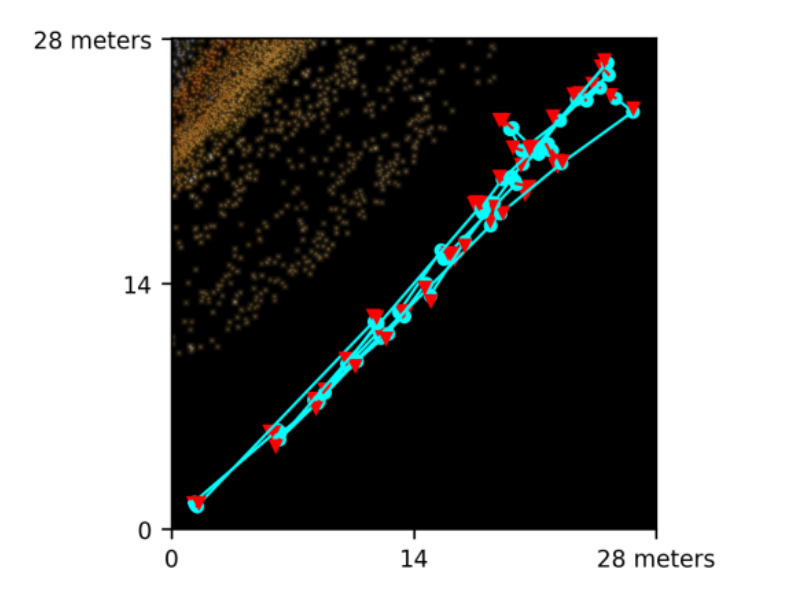
By using tools like OpenDroneMap (ODM), we processed high-resolution images captured mid-flight to map the aircraft’s trajectory and reconstruct key flight path features. In our recent tests, we achieved a 92.4% accuracy rate, which confirmed the reliability of our system and laid a strong foundation for further enhancements to our mapping algorithms.
This achievement was not just about the accuracy figures. It marked a critical step in strengthening our 3D models and ensuring the flight data remained highly reliable. We successfully reconstructed 1,189 out of 1,702 key features, further improving the integrity of our models. Additionally, we reduced the GPS error margin to less than 4 meters, which improved location accuracy and increased the overall reliability of the system.
These advancements have opened up new possibilities for precision mapping, with applications in navigation, route planning, and obstacle detection. We will continue refining the system and look forward to the ongoing improvements it will bring.
Key Achievements:
- Achieved 92.2% Accuracy in reconstructing mapping points, improving flight data fidelity.
- Reconstructed 1,189 out of 1,702 Features, strengthening our 3D model’s integrity.
- Reduced GPS Error Margin to <4 Meters, increasing location precision and reliability.